

On May 31, 2005, doctoral candidate Krishna Vatsa defended his research on “Asset-Based Approach to Household Risk Management: An Analysis of Selected Case Studies in South Asia.”
This project focused on understanding global disaster losses and impacts: hazard and vulnerability in the context of human development, financial services and instruments for disaster risk reduction, and risk, vulnerability and asset-based approaches to disaster risk management.
His research employed a case study method, focusing on the following three major case studies:
- Earthquake Reconstruction in Maharashtra, India: Impact on Assets, Income, Participant and Equity
- Bangladesh Floods, 1998: Microfinance Services for Household Coping and Recovery
- Employment Guarantee Scheme in Maharashtra: Its Impact on Drought, Poverty and Vulnerability.

On May 19, 2005, doctoral candidate Yusuf Al Malki defended his research on “Construction Delay Factors within the Private Sector Projects in the GCC Countries Represented by the Kingdom of Bahrain.” The project examined delays posed by environmental considerations, including environmental protection regulations and permitting requirements, among other causes.
The purpose of the study was to investigate and evaluate the major factors involved in Gulf Cooperation Council (GCC) countries, with the Kingdom of Bahrain examined specifically. The outcome of the research should help to improve the overall quality as well as the efficiency of the construction industry in the GCC countries so as to enhance investors’ interest in private projects while protecting the resources that are important to the GCC societies. It also should provide construction parties with recommendations that will help them in improving their design, scheduling, overall performance, and cost effectiveness.
To investigate the major factors of construction delay, a survey was distributed to 670 participants in the private construction sector in Bahrain. Two methods were used to distribute the survey: a direct distribution method (personally distributed) and an online Internet version. The participants’ response rate was 63.3 percent. Based on the results, a number of recommendations were suggested to reduce construction delay in private sector projects in GCC countries.

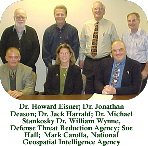
Doctoral Candidate Sue Hall successfully defended her doctoral dissertation on November 30, 2005. Sue’s dissertation was entitled “Improving the Integration of Imagery and Remote Sensing Resources for Environmental Emergency Preparedness and Response in the United States: Operationalizing the Open Skies Concept for All-Weather Airborne Data Collection.”
Sue’s research was focused on optimizing utilization of the great advances that have been made in recent years in the use of imagery and remote sensing for monitoring and protecting the environment, and in disaster preparedness and response. Environmental emergency preparedness planners now have a vast "constellation" of imagery and remote sensing resources available to observe and respond to environmental disasters. These resources are used to prepare for hurricanes and floods as well as recover from their effects; observe wildfires and forest fires and work to contain them; and respond to other disasters, thus protecting lives, valuable property, and the environment.
Unfortunately, these imagery resources and their associated systems, as useful as they are, are not necessarily integrated nor marshaled in any coherent web in support of those protecting lives, property or the environment. With the new openness, declassification and commercial availability of high-resolution imagery, remote-sensing capabilities now available to preparedness and response individuals range from satellite sensors to aircraft platforms.
Sue’s dissertation, utilizing the operational concept envisioned in the preamble of the Open Skies Treaty, involved the development of an improved methodology for integrating imagery resources into airborne command-and-control systems for dealing with environmental protection and disasters. The focus of the research was on the use of all-weather airborne platforms. The Open Skies All Weather Airborne Data Collection System was used as a test bed to verify and validate the integration methodology that was developed.
The research provided evidence of an airborne system with multiple interchangeable sensors and a cooperative operational concept that could be applied to many environmental problems. Through numerous case studies, the research examined the results of extensive deployment and testing in the context of real domain experts doing real work. It evaluated applications of the system in multiple case studies and compared the efficacy of this type of system with that of commercial satellites.