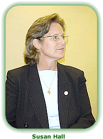
On October 12, 2004, Susan W. Hall passed into doctoral candidacy status with a successful defense of her research proposal entitled “Improving the Integration of Imagery and Remote Sensing Resources for Environmental Emergency Preparedness and Response in the United States: Operationalizing the Open Skies Concept for All-Weather Airborne Data Collection.”
In recent years, great advances have been made in the use of imagery and remote sensing for monitoring and protecting the environment, and in disaster preparedness and response. Environmental emergency preparedness planners now have a vast "constellation" of imagery and remote sensing resources available to observe and respond to environmental disasters. The groups that have benefited from this technology range from federal, state and local emergency management agencies down to the first responders. These resources are used to prepare for hurricanes and floods and recover from their effects; observe wildfires and forest fires and work to contain them; and respond to other disasters, thus protecting lives, valuable property, and the environment.
However, as useful as these new imagery resource tools are, Sue has found that they are not optimally integrated nor marshaled in a coherent way to support of those protecting lives, property or the environment. Sue’s literature investigation to date has led her to the conclusion that, with the new openness, declassification and commercial availability of high-resolution imagery, remote-sensing capabilities now available to preparedness and response individuals.
In her proposal defense, Sue described these types of resources as analogous to those at the disposal of military intelligence specialists (and in some cases may actually be the same). As is the case with military systems of their type, however, the integration and command-and-control of the resources for environmental emergency preparedness purposes, and the availability and dissemination of their products, is quite problematic.
Sue’s research is involved with an investigation of ways to improve the integration of resources for environmental preparedness and response. It involves the development of an improved methodology for integrating imagery resources into airborne command-and-control systems for dealing with environmental protection and disasters, focusing on the use of all-weather airborne platforms. She anticipates that the Open Skies All Weather Airborne Data Collection System will be used as a test bed to verify and validate the integration methodology to be developed.
The Open Skies System has both technical and political-organizational aspects. The technical aspects relate to the fact that the system is based on a readily available airborne platform with capabilities for scientific and emergency analysis and command and control on board, and that it has a variety of interchangeable sensors. The organizational aspect relates to the fact that it can be readily adapted for command and control and systems integration purposes involving interagency and international cooperative missions.
Sue’s proposed research seeks to contribute an airborne system with multiple interchangeable sensors and a cooperative operational concept that can be applied to many environmental problems. Through numerous case studies and structured interactions with experts, her research will examine the results of extensive deployment and testing in the context of real domain experts doing real work. It also will evaluate applications of the system in several case studies and will compare the efficacy of this type of system with that of commercial satellites.
Serving on Sue’s Research Committee are Dr. Jack Harrald, lead professor of the Crisis, Emergency and Risk Management concentration; Dr. Howard Eisner, lead professor of the Systems Engineering and Integration concentration; and Dr. Jonathan Deason, lead professor of the Environmental and Energy Management concentration.


